Hancock County (Georgia) Cemeteries
Cemetery details
Brundage Family Cemetery

Location:
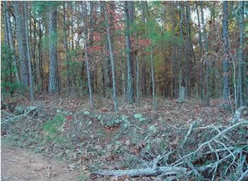
From the Hancock County Courthouse, go west on Hwy 22 for 0.2 mile. Turn right on Dixie Road. Go 1 mile. Turn left on Lake Shore Road (old Pumping Station Road) and proceed 7.8 miles to the T intersection with Warren Chapel Road. Turn right on old Harper Cemetery Road (Note: this "T" intersection with Pumping Station/Lake Shore Road has Warren Chapel Road to the left and Harper Cemetery Road / Rives Rd. / Crestline Dr. to the right). Turn right on old Harper Cemetery Road and go 1.5 miles. The cemetery is on the left side of the road, about 75 feet away from the road and 15 feet into the woods.
From the Hancock County Courthouse, go west on Hwy 22 for 0.2 mile. Turn right on Dixie Road. Go 1 mile. Turn left on Lake Shore Road (old Pumping Station Road) and proceed 7.8 miles to the T intersection with Warren Chapel Road. Turn right on old Harper Cemetery Road (Note: this "T" intersection with Pumping Station/Lake Shore Road has Warren Chapel Road to the left and Harper Cemetery Road / Rives Rd. / Crestline Dr. to the right). Turn right on old Harper Cemetery Road and go 1.5 miles. The cemetery is on the left side of the road, about 75 feet away from the road and 15 feet into the woods.
GPS coordinates: 33 17' 29.0" N 83 07' 42.1" W
or in degrees only form: 33.29139° N X 83.12836° W
See location on a Google map in a new window (NOTE:The map opens in a new window. The cemetery will be at the location indicated by a red marker.)
GMD: 101
Cemetery Status: Inactive
Predominant race: Black
Indexer or Contributor: Winston Stembridge, Mona L. and F. Dean Williams
Unmarked Adult Grave - Henry Brundage
- 1906
Age 60. Grave not found in 2003. All info per Kimbrough list.
Grave 2
Unmarked Graves
As many as 50 graves, some with rocks as headstones and footstones.
Grave 3