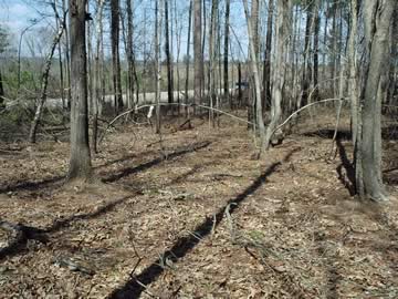
Hancock County (Georgia) Cemeteries
Cemetery details
Ebenezer Cemetery on Carr's Station Rd.
Appears as if it may be an old church cemetery

Location:
From the Hancock County Courthouse, take Hwy 22 southwest for 7.2 miles to Devereux. Turn right (at backwards fork) onto Main Street. Go 0.2 mile to the dead end and turn left on Jones Chapel / Devereux Rd. Go 4.9 miles. Turn right (west) on Carr's Station Road and go 3.7 miles to 154/156 Carr's Station Rd. This address is on the left at Easy St, formerly called Hollis Rd. The cemetery is on the right and directly across the street from where Easy St./Hollis Rd. intersects Carr's Station Rd.
From the Hancock County Courthouse, take Hwy 22 southwest for 7.2 miles to Devereux. Turn right (at backwards fork) onto Main Street. Go 0.2 mile to the dead end and turn left on Jones Chapel / Devereux Rd. Go 4.9 miles. Turn right (west) on Carr's Station Road and go 3.7 miles to 154/156 Carr's Station Rd. This address is on the left at Easy St, formerly called Hollis Rd. The cemetery is on the right and directly across the street from where Easy St./Hollis Rd. intersects Carr's Station Rd.
The cemetery is 0.4 mile from the intersection of Carr's Station Rd and Lake Sinclair Dr.
GPS coordinates: 33 10' 45.6" N 83 11' 42.6" W
or in degrees only form: 33.17933° N X 83.19517° W
See location on a Google map in a new window (NOTE:The map opens in a new window. The cemetery will be at the location indicated by a red marker.)
GMD: 116
Cemetery Status: Inactive
Predominant race: Black
Name of cemetery from death certificates of those buried here.
Indexer or Contributor: Warren Layfield and Susan Harrington
Mr. Ephean Anderson
Mar 16, 1880 - Feb 17, 1942
Age 62 yrs. Dates handwritten on slab and from Slater's Funeral Home tag.
Click for more info.
Click for more info.
Grave 1
Thomas Anderson
Apr 7, 1915 - Jun 27, 1937
Handwritten on slab.
Grave 2
Unmarked Grave - Thomas Moore
- Feb 10, 1942
Age 71. Grave is surrounded by wire fence. Info from Slater's Funeral Home tag.
Click for more info.
Click for more info.
Grave 3
Unmarked Graves
Possibly 200 graves.
Grave 4