Hancock County (Georgia) Cemeteries
Cemetery details
James Butts Family Cemetery


Location:
From the Hancock County Courthouse, go southwest on Hwy 22 for 7.2 miles to Devereux. Turn right (at the backwards fork) onto Main Street. Go 0.2 mile to the dead end and turn left on Jones Chapel / Devereux Rd. Go approximately 2 miles to Powell Grove road on your right. Go on Powell Grove Rd. for 1.4 miles to the end of the pavement and the intersection of Powell Grove, Sandy Run Rd and King Rd. Take Sandy Run Rd which is straight ahead. Follow Sandy Run for 1.5 miles to where it splits. Turn left (onto Road number 148) at the split. Go 0.3 mile to a logging road on the left. Follow (walk) the logging road for 0.8 mile to the cemetery, which will be on the right side of the logging road. The cemetery is on a ridge which looks down on Island Creek to its south.
From the Hancock County Courthouse, go southwest on Hwy 22 for 7.2 miles to Devereux. Turn right (at the backwards fork) onto Main Street. Go 0.2 mile to the dead end and turn left on Jones Chapel / Devereux Rd. Go approximately 2 miles to Powell Grove road on your right. Go on Powell Grove Rd. for 1.4 miles to the end of the pavement and the intersection of Powell Grove, Sandy Run Rd and King Rd. Take Sandy Run Rd which is straight ahead. Follow Sandy Run for 1.5 miles to where it splits. Turn left (onto Road number 148) at the split. Go 0.3 mile to a logging road on the left. Follow (walk) the logging road for 0.8 mile to the cemetery, which will be on the right side of the logging road. The cemetery is on a ridge which looks down on Island Creek to its south.
GPS coordinates: 33 13' 26.1" N 83 09' 14.6" W
or in degrees only form: 33.22392° N X 83.15406° W
See location on a Google map in a new window (NOTE:The map opens in a new window. The cemetery will be at the location indicated by a red marker.)
GMD: 101
Cemetery Status: Inactive
Predominant race: White
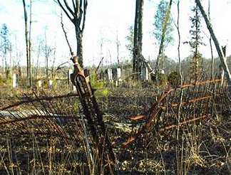
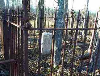
A GPS system is recommended. Currently extensive logging has occurred all around the cemetery. The cemetery sits within an iron fence within some trees on the ridge.
The cemetery is on a hill just beyond a hill with the Butts-Simmons Families Cemetery.
Indexer or Contributor: Kathy Fuller, Warren Layfield, Susan Harrington
T. J. Jones, MD
Jun 3, 1829 - Mar 8, 1898
Stone broken at death year. Death year per Kimbrough list.
Grave 2
Tommie E. Jones
Oct 24, 1858 - Feb 1, 1873
s/o T. J. and E. A. Jones.
Grave 3
Leola
A child-sized grave with no last name nor dates.
Grave 4
Charlton
A child-sized grave with no last name nor dates.
Grave 5
Guy
A child-sized grave with no last name nor dates.
Grave 6
Ina Coleman
Sep 6, 1894 - Oct 13, 1913
"Only sleeping" d/o T. H. and E. B. Coleman.
Click for more info.
Click for more info.
Grave 7
Thomas H. Coleman
Jun 8, 1856 - Oct 17, 1914
"Father" On same stone as Ellen Butts Coleman.
Click for more info.
Click for more info.
Grave 10
Ellen Butts Coleman
b. Jul 31, 1852
"Mother" No death date. On same stone as Thomas H. Coleman.
Grave 11
J. Wallace Butts, MD
Feb 17, 1839 - Aug 1, 1890
Grave 12
Saleta H. Butts
1815 - 1892
"Mother"
Grave 14
James I. Butts
1800 - 1887
"Father"
Grave 15
Alpheus S. Butts
Grave 16
Little Garfield
No last name nor dates.
Grave 17
Unmarked Graves
Possibly 1-15 unmarked graves.
Grave 19