Hancock County (Georgia) Cemeteries
Cemetery details
Jernigan Cemetery


Location:
From the Hancock County Courthouse, go north on Hwy 15 for 13.7 miles to Bridget Dr. on right. You will be in Greene County. Follow Bridget Dr for less than half a mile to a residential gate. Gain permission and go through the gate for approximately 500 feet. The cemetery is about 50 feet on the right and is visible from the driveway.
From the Hancock County Courthouse, go north on Hwy 15 for 13.7 miles to Bridget Dr. on right. You will be in Greene County. Follow Bridget Dr for less than half a mile to a residential gate. Gain permission and go through the gate for approximately 500 feet. The cemetery is about 50 feet on the right and is visible from the driveway.
GPS coordinates: 33 27' 21" N 83 01' 46" W
or in degrees only form: 33.45583° N X 83.02944° W
See location on a Google map in a new window (NOTE:The map opens in a new window. The cemetery will be at the location indicated by a red marker.)
GMD: 103
Cemetery Status: Inactive
Name based on the Greene County Cemetery Book.
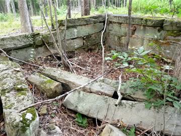
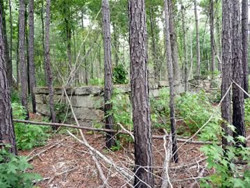
A walled cemetery approximately 30' X 12' X 3' high. There are no marked graves. There are depressions and rocks on the outside of the wall in addition to the graves inside the wall.
Indexer or Contributor: Monty Laster and Dr. Steve Carter
Unmarked Graves Jernigan
Name based on Greene County Cemetery book. It is unknown if the name is for those buried here or the name of a former property owner.
Grave 1