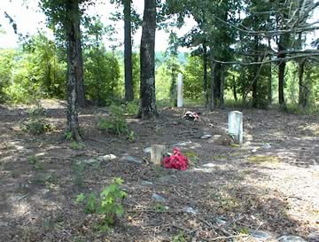
Hancock County (Georgia) Cemeteries
Cemetery details
Osborne Family Cemetery

Location:
From the Hancock County Courthouse, go east 2 blocks (0.2 mile) to Boland Street. Turn right on Boland Street (which eventually becomes Linton Rd) and go 9.2 miles (which is about 0.4 mile past the Beulah Hwy - Linton Rd split). Turn left on Ridge Rd. Travel 1.5 miles to a log road. Turn right on the log road. The cemetery is 500 feet or 0.1 mile from Ridge Rd. and on the left side of the logging road.
From the Hancock County Courthouse, go east 2 blocks (0.2 mile) to Boland Street. Turn right on Boland Street (which eventually becomes Linton Rd) and go 9.2 miles (which is about 0.4 mile past the Beulah Hwy - Linton Rd split). Turn left on Ridge Rd. Travel 1.5 miles to a log road. Turn right on the log road. The cemetery is 500 feet or 0.1 mile from Ridge Rd. and on the left side of the logging road.
GPS coordinates: 33 08' 35.9" N 82 59' 23.0" W
or in degrees only form: 33.14331° N X 82.98972° W
See location on a Google map in a new window (NOTE:The map opens in a new window. The cemetery will be at the location indicated by a red marker.)
GMD: 118
Cemetery Status: Inactive
Predominant race: White
The lot around George Washington Ausborne / Osborne's grave is surrounded by stone coping, which is large enough to hold as many as 8 graves in addition to Osborne's.
Indexer or Contributor: Christy and Glen Cook
George Washington (Ausborne) Osborne
Jan 1830 - Jan 1903
Dates per family records. No date appears on gravestone. Marker is spelled "Ausborne", but the family believes it should be spelled "Osborne".
Military Service: Confederate States of America
Co. I, 59 Regt. Ga. Inf.
Military Service: Confederate States of America
Co. I, 59 Regt. Ga. Inf.
Grave 1
Unmarked Graves
At one time, more graves were visible in this cemetery.
Grave 2
cat
George Washington Osborne's black cat is buried under some rocks near its owner.
Grave 3