Hancock County (Georgia) Cemeteries
Cemetery details
Unnamed Cemetery #12 on northern Centennial Road

Location:
From the Hancock County Courthouse, go 8.0 miles northwest of Sparta on Hwy 16. You will cross Shoulderbone Creek and pass state highway 77 north. Turn right on Centennial Road and go 2.7 miles to a gate on your right. Walk or drive 0.6 mile to a fork in the road. Take the right fork and go another 150 feet. The cemetery is on your left in the woods.
From the Hancock County Courthouse, go 8.0 miles northwest of Sparta on Hwy 16. You will cross Shoulderbone Creek and pass state highway 77 north. Turn right on Centennial Road and go 2.7 miles to a gate on your right. Walk or drive 0.6 mile to a fork in the road. Take the right fork and go another 150 feet. The cemetery is on your left in the woods.
GPS coordinates: 33 22' 51.7" N 83 04' 58.5" W
or in degrees only form: 33.38103° N X 83.08292° W
See location on a Google map in a new window (NOTE:The map opens in a new window. The cemetery will be at the location indicated by a red marker.)
GMD: 103
Cemetery Status: Inactive
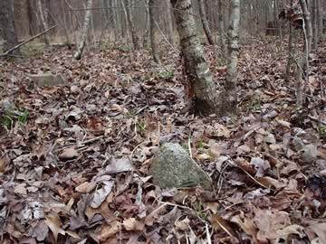
This is a cemetery with 2 rows of depressions and 6 graves set off from the rows but near to them (23 identifiable graves in total). The 6 graves are located at 33 22' 50.1" N 83 04' 58.4" W.
Indexer or Contributor: Bill Jackson, Russell Poss, and Susan Harrington
Unmarked Graves
2 rows of depressions with 17 identifiable graves.
Grave 1
Unmarked Graves
5 graves in a row, plus one grave at the top of the end grave, set off from the 2 rows.
Grave 2