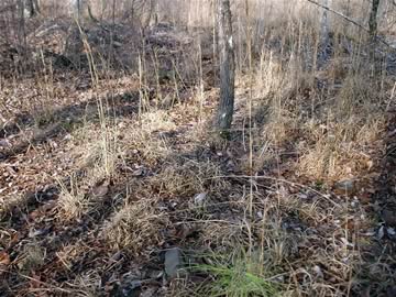
Hancock County (Georgia) Cemeteries
Cemetery details
Unnamed Cemetery #24 in Devereux
destroyed

Location:
From the Hancock County Courthouse, go southwest on Hwy 22 for 8.4 miles. Turn left on a woods road. Drive 1.4 mile. The cemetery was on your right but only a few scattered bricks remain visible.
From the Hancock County Courthouse, go southwest on Hwy 22 for 8.4 miles. Turn left on a woods road. Drive 1.4 mile. The cemetery was on your right but only a few scattered bricks remain visible.
GPS coordinates: 33 11' 11.5" N 83 03' 51.9" W
or in degrees only form: 33.18653° N X 83.06442° W
See location on a Google map in a new window (NOTE:The map opens in a new window. The cemetery will be at the location indicated by a red marker.)
GMD: 116
Cemetery Status: Inactive
The cemetery shows on a plat map of the property as part of a 2-acre church lot.
Indexer or Contributor: Wright Banks, Warren Layfield and Susan Harrington