Hancock County (Georgia) Cemeteries
Cemetery details
Warren / Warrne Family Cemetery


Location:
From the Hancock County Courthouse, go west on Hwy 22 for 0.3 mile to Old Milledgeville Rd. (also called Dixie St.). Turn right and go 0.6 mile and cross railroad track to fork in road. Take the left fork on St. Marks Church Road and go 0.8 mile. Cemetery is to the left of paved road approximately 150 yards.
From the Hancock County Courthouse, go west on Hwy 22 for 0.3 mile to Old Milledgeville Rd. (also called Dixie St.). Turn right and go 0.6 mile and cross railroad track to fork in road. Take the left fork on St. Marks Church Road and go 0.8 mile. Cemetery is to the left of paved road approximately 150 yards.
GPS coordinates: 33 16' 36" N 83 00' 19' W
or in degrees only form: 33.27667° N X 83.00528° W
See location on a Google map in a new window (NOTE:The map opens in a new window. The cemetery will be at the location indicated by a red marker.)
GMD: 102
Cemetery Status: Inactive
Predominant race: Black
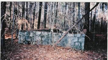
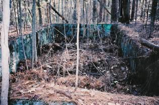
Rock wall around cemetery 15' wide and 30' long and 3' high.
Indexer or Contributor: Russell Poss
Willie Warrne
Adult-sized concrete slab. No dates. Last name may be misspelled and may be Warren.
Grave 1
Agnes Warrne
Adult-sized concrete slab. No dates. Last name may be misspelled and may be Warren.
Grave 2
Eddie Warrne
Adult-sized concrete slab. No dates. Last name may be misspelled and may be Warren.
Grave 3
Adeline Warren
Adult-sized concrete slab. No dates.
Grave 4
Unmarked Graves
There are at least 6 graves outside of the rock wall.
Grave 5