Unnamed Cemetery 01
Description: Located off of forest service road 903.
Location: From Ocmulgee River Bridge on Ga Hwy 18, travel east approximately 1.6 miles to Jarrell Plantation Rd. Turn left, go approximately 2.4 miles to Hitchiti Road, turn right, travel approximately 2.6 miles to intersection of Forest Service Road. Turn left, travel approximately 3/4 mile to sharp right turn. Cemetery is located in woods to right of road.

GPS coordinates in degrees only form: 33.06508° N X 83.6758° W
See location on a Google map in a new window (NOTE:The map opens in a new window. The cemetery will be at the location indicated by a red marker.)

Dist. 11 Land Lot 78
Date surveyed: July 4, 2001
Cemetery Status: Inactive


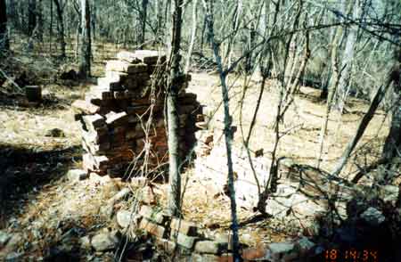
Other info: Approximately 23 unmarked graves, with one brick mausoleum in ill repair.

Indexer(s) or Contributor(s): Earl Colvin

List of Graves

Pers No.NameBirthDeathInscription and NotesService
0    Unmarked cemetery with 23 recognizable
graves. One being a brick mausoleum.


Please e-mail comments or questions to Susan J. Harrington at moreinfo@NOSPAM_FriendsofCems.org
(Remove "NOSPAM_" from the TO address in your email before sending.)

Return to Jones County Cemeteries home page