Hancock County (Georgia) Cemeteries
Cemetery details
Veazey Family Cemetery


Location:
From the Hancock County Courthouse, go southwest on Hwy 22 for 7.2 miles to the intersection of Hwy 22 and Main Street in Devereux. Turn right (at the backward fork) onto Main Street and go 0.2 mile until it dead ends into Jones Chapel Road. Turn left and follow Devereux / Jones Chapel Road for 4.9 miles to Carr Station Road. Turn right on Carr's Station Road and go 3.7 miles to Lake Sinclair Drive. Turn right on Lake Sinclair Drive and go 3.8 miles to Island Creek Drive. Turn left on Island Creek Drive andn go 1.7 miles to Azalia Trail. Turn left on Azalia Trail and go 0.3 mile to a locked gate and white picket fence across the road.
Approximately 100 yards back from the gate and fence, go left to center of Georgia Power high voltage line. The graves are about 75 feet from the road under power lines.
GPS coordinates: 33 11' 38.5" N 83 12' 38.5" W
or in degrees only form: 33.19403° N X 83.21069° W
See location on a Google map in a new window (NOTE:The map opens in a new window. The cemetery will be at the location indicated by a red marker.)
GMD: 104
Cemetery Status: Inactive
Predominant race: White
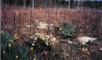
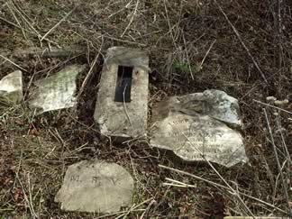
Cemetery almost completely destroyed.
Indexer or Contributor: Russell Poss and Warren Layfield
Lump Smith Veazey
Nov 13, 1850 - Sep 28, 1877
w/o J. R. Veazey, d/o Geo. G. and E. F. Smith. "My darling is at rest"
Click for more info.
Click for more info.
Grave 1
Infant dau. of J. R. & M. R. Veazey
On bottom of a broken stone, with "A wife on Earth, an Angel in Heaven" above inscription
Click for more info.
Click for more info.
Grave 2
Carlie Smith
child of G. G. and E. F. Smith. Word between Carlie and child of unreadable.
Grave 3
Unmarked Graves
Possible other graves. Headstones and other markers knocked down and broken.
Grave 5