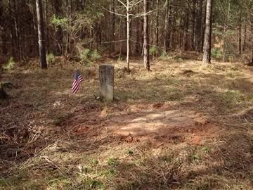
Location:
From the Baldwin County Courthouse, go east on Hancock St. and follow Highway 22 (Sparta Hwy) east 6.4 miles to Linton Rd. (Linton Rd is 2 miles past the fork where Highway 24 separates from Highway 22.) Turn right on Linton Rd. Go 1.4 miles to an old field road on the left. Turn left and follow the field road approximately 500 feet to a gate (where the woods begins). Walk or drive 0.2 mile on the woods road to a fork where the main road goes to the left. The site of where the old building used to be is on your left, with a large tree. Bear right at the fork (which is nearly straight ahead). Walk 200 feet down the trail. Turn right and walk 100 feet on a path going slightly up a hill. The cemetery is on your left.
GPS coordinates: 33 06' 52.3" N 83 07' 12.6" W
or in degrees only form: 33.11453° N X 83.12017° W
See location on a Google map in a new window (
NOTE:The map opens in a new window. The cemetery will be at the location indicated by a red marker.)
GMD: 105
Cemetery Status: Inactive
Predominant race: White


